Unmarked Maps of Iraq
and Syria
Click each map for a large, VERY detailed image - note file sizes.
Click HERE for a
University of Texas link to other downloadable maps produced by the CIA.
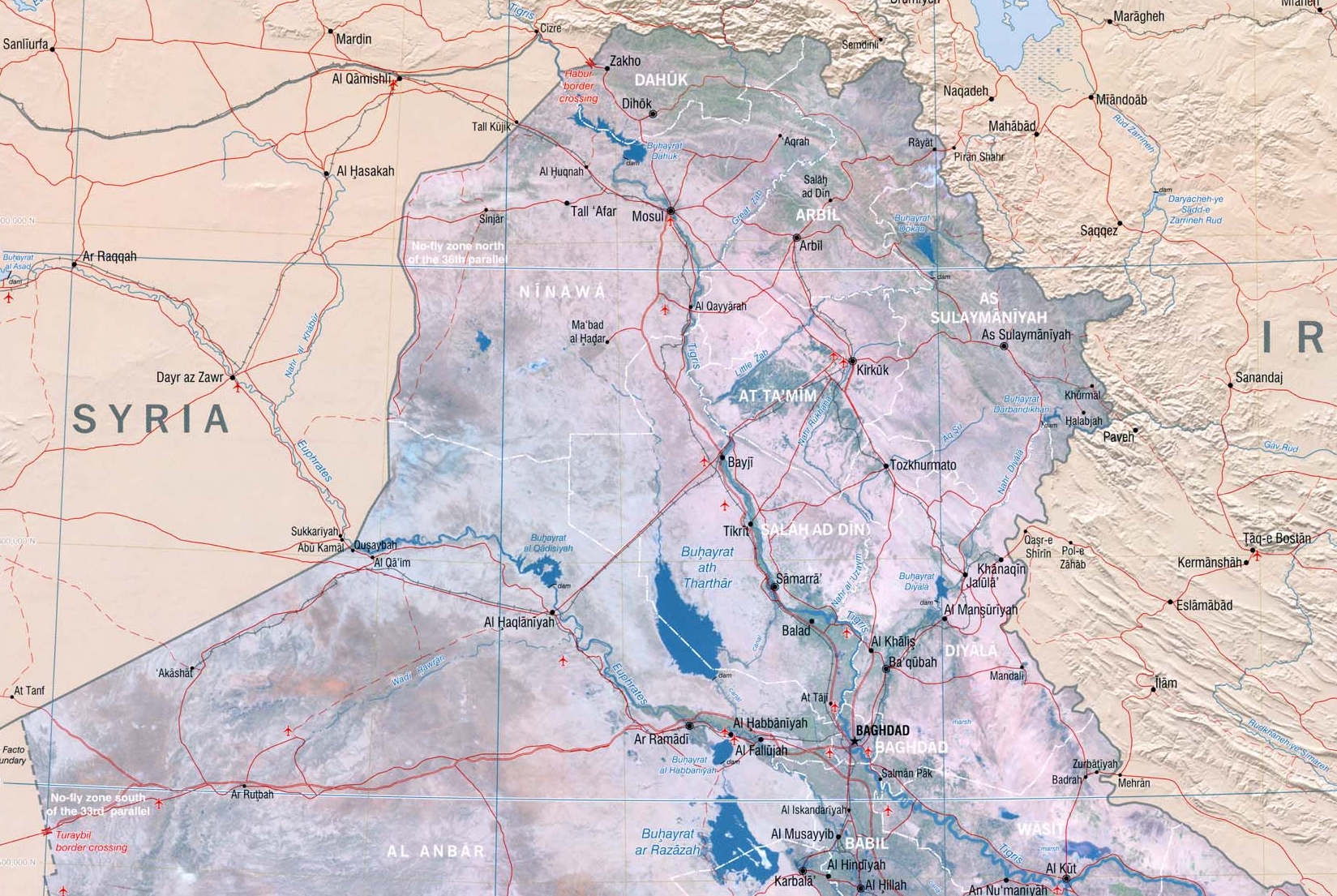
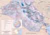
 Northern three/quarters of Iraq - unmarked
File size approx. 1.7MB
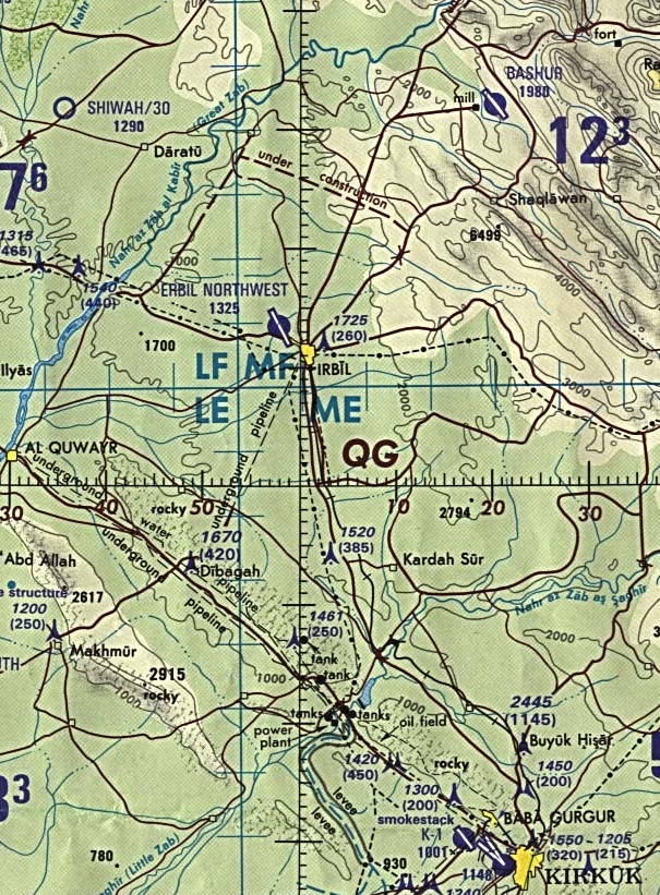
 Detailed
aero map of the Irbil area - click to enlarge. (As
noted by Col. T. E. Lawrence - even among the various tribes of Arabia, names of
places and people are often spelled differently, especially when rendered into
English. Irbil is as often found on maps and in references as Arbil.)
The airfield occupied by a night-time airborne operation by
elements of the 173rd Airborne Brigade supported by Special Ops teams on the ground may be the same strip found on the
chart at BASHUA, to the northeast of IRBIL, where Nash Devon met the Canadian Peacekeepers'
CC-130 and received the "Grain Moisture Analyzer," a disguised SATCOM
transceiver, in the fictional plot of Desert
Winds. File size approx.
490KB.
Detailed
aero map of the Irbil area - click to enlarge. (As
noted by Col. T. E. Lawrence - even among the various tribes of Arabia, names of
places and people are often spelled differently, especially when rendered into
English. Irbil is as often found on maps and in references as Arbil.)
The airfield occupied by a night-time airborne operation by
elements of the 173rd Airborne Brigade supported by Special Ops teams on the ground may be the same strip found on the
chart at BASHUA, to the northeast of IRBIL, where Nash Devon met the Canadian Peacekeepers'
CC-130 and received the "Grain Moisture Analyzer," a disguised SATCOM
transceiver, in the fictional plot of Desert
Winds. File size approx.
490KB.
Southern three/quarters of Iraq -
unmarked
File size approx. 1.7MB
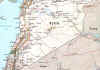
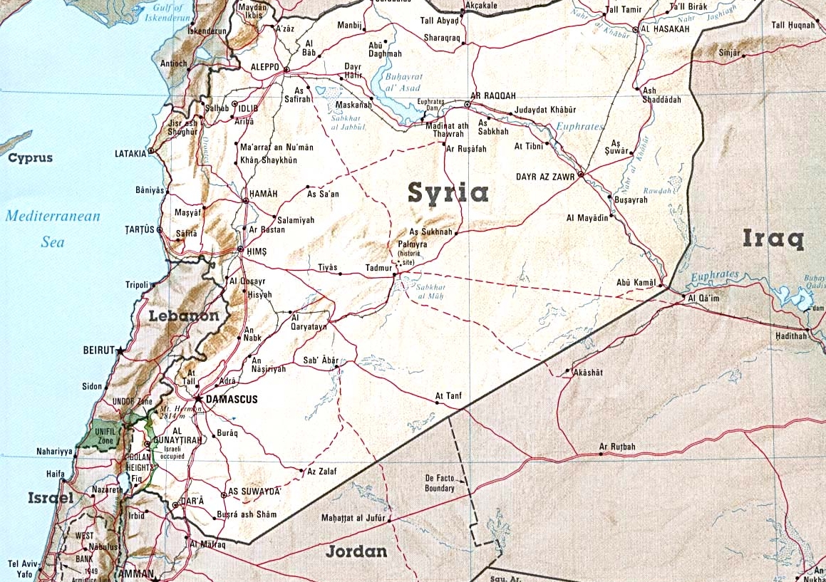
Syria - unmarked
File size approx. 0.9MB
Go to the separate Iraq and
Syria marked map pages to see the details of Nash Devon's
travels in Desert Winds.
Caution - too close of an examination
of the marked maps may give away more of the plot than you want to know before
you have reached the end.
back to top